
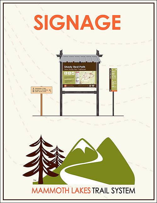
Signage and Wayfinding

Project Description: In January of 2010, MLTPA convened the community through the “Mammoth Trails Map, Signage & Wayfinding Committee”, local citizens and stakeholders, to lay the foundation for the Mammoth Lakes Trail System’s Signage and Wayfinding program. Over a series of meetings, these local citizens and stakeholders established the aesthetic and nomenclature conventions that “live on” in the signage of the Mammoth Lakes Trail System and are visible on the ground today.
Guided by Chapter 5 of the Town’s “Trail System Master Plan” and the expertise of Corbin Design of Traverse City Michigan, the Mammoth Lakes Trail System’s Signage and Wayfinding program has been widely implemented throughout Mammoth Lakes and is a source of community pride.
Implementation Efforts of the MLTS Signage and Wayfinding Program
The Mammoth Lakes Trail System includes a wide variety of infrastructure that requires proper signage. Links below detail implementation efforts, including for “Hard Surface Trails,” “Soft Surface Trails,” and “Regulatory Signage,” along with the documentation of all of these efforts in the Town of Mammoth Lakes Department of Public Works Standards Manual.
MLTS Signage and Wayfinding - Hard Surface Trails
Click above to access the webpage for the Mammoth Lakes Trail System’s Signage and Wayfinding program for “Hard Surface Trails”, with all of the information you’ll need for signage and wayfinding on “hard surface” facilities, or Multi Use Paths (MUPs).
MLTS Signage and Wayfinding – Soft Surface Signage
Click above to access the webpage for the Mammoth Lakes Trail System’s Signage and Wayfinding program for “Soft Surface Trails”, with all of the information you’ll need for signage and wayfinding on trails that exist mostly on lands managed by the U.S. Forest Service.
MLTS Signage and Wayfinding – Regulatory Signage
Click above to access the webpage for the Mammoth Lakes Trail System’s Signage and Wayfinding program for “Regulatory Signage”, with all of the information you’ll need for the regulatory and seasonal signage that is used throughout the Mammoth Lakes Trail System.
TOML PUBLIC WORKS - SECTION 600 MLTS - JULY, 2013
Click above to view a version of the Town of Mammoth Lakes - Dept. of Public Works "Section 600" - Mammoth Lakes Trail System's detailed standards document including design and implementation of signage and wayfinding, multi-use paths, trail amenities, and other pedestrian facilities.
Development of the MLTS Signage and Wayfinding Program
The MLTS Signage and Wayfinding Program originated with members of the Mammoth Lakes community that worked with MLTPA in 2010 to get this important program underway. The community's effort, the Town’s “Trail System Master Plan,” and the expertise of Corbin Design of Traverse City Michigan, produced the Mammoth Lakes Trail System’s Signage and Wayfinding program that is on the ground in Mammoth Lakes today.

MAMMOTH TRAILS MAP, SIGNAGE & WAYFINDING COMMITTEE
In 2010, at the very beginning of the Mammoth Lakes Trail System Signage and Wayfinding effort, MLTPA engaged the community through the "Mammoth Trails: Map, Sign and Wayfinding Committee" to establish aesthetic standards for the signage program.

The Big Map
A critical part of implementing the Signage and Wayfinding program is the definition of the “subregions” within the Town’s Planning Area where outdoor recreation takes place. MLTPA produced this ‘big map” in 2006 as an advocacy tool for the Mammoth Lakes Trail System – click above to have look.

Wayfinding and Signage: The Essential Steps to Success
Jeffrey Corbin - founder of Corbin Design - gave this presentation at “Camp: Summer” in 2007, the first of two large-scale public meetings produced by MLTPA as part of the campaign for a new Trail System Master Plan starting in 2006. Click above to download and review Jeffrey Corbin's presentation.

Ten Wayfinding Questions
Corbin Design provided this document which documents 10 questions that are often asked when thinking about developing a wayfinding program for a city, campus, facility, or even a trail system. Click above to download the document - the answers to your questions may lie within!

Susan S. Hunter, Ph.D.
“Wayfinding encompasses the information-gathering and decision-making processes people use to orient themselves and move through space; simply put, how people get from one location to another.” Corbin Design shared Dr. Hunter’s academic article - click above to download and review this insightful research.

Trail System Master Plan (2011) - “Signage and Wayfinding”
Corbin Design was asked to analyze trail wayfinding and make recommendations for an attractive, consistent and expandable wayfinding and signage system. These recommendations were memorialized in Chapter 5 of the Trail System Master Plan.

Design Intent Drawings for Trail & Node Signage - 2009
This may be the first set of “design intent” drawings produced for the Mammoth Lakes Trail System Signage and Wayfinding program – but it certainly wasn’t the last! Click above to download and review, and be sure to visit the “Hard Surface” and “Soft Surface” web pages to see the current versions.

MLTS Signage and Wayfinding Photo Gallery
The American Recovery and Reinvestment Act financed the production and installation of the vast majority of new signs for the “hard surface” trails back in 2010. MLTPA, Town Staff, Mono County GIS Staff, and U.S. Forest Service worked together on this important project.
Last updated December 10, 2023